








Hyper Naked MT-10: A Blue Ridge Parkway Fall Ride
At its peak elevation the Blue Ridge Parkway bends and twists to the rider’s will, and a hyper naked MT-10 with no fairing gives the pilot the added visceral treat of the cool mountain air. / Oct 12, 2026 /
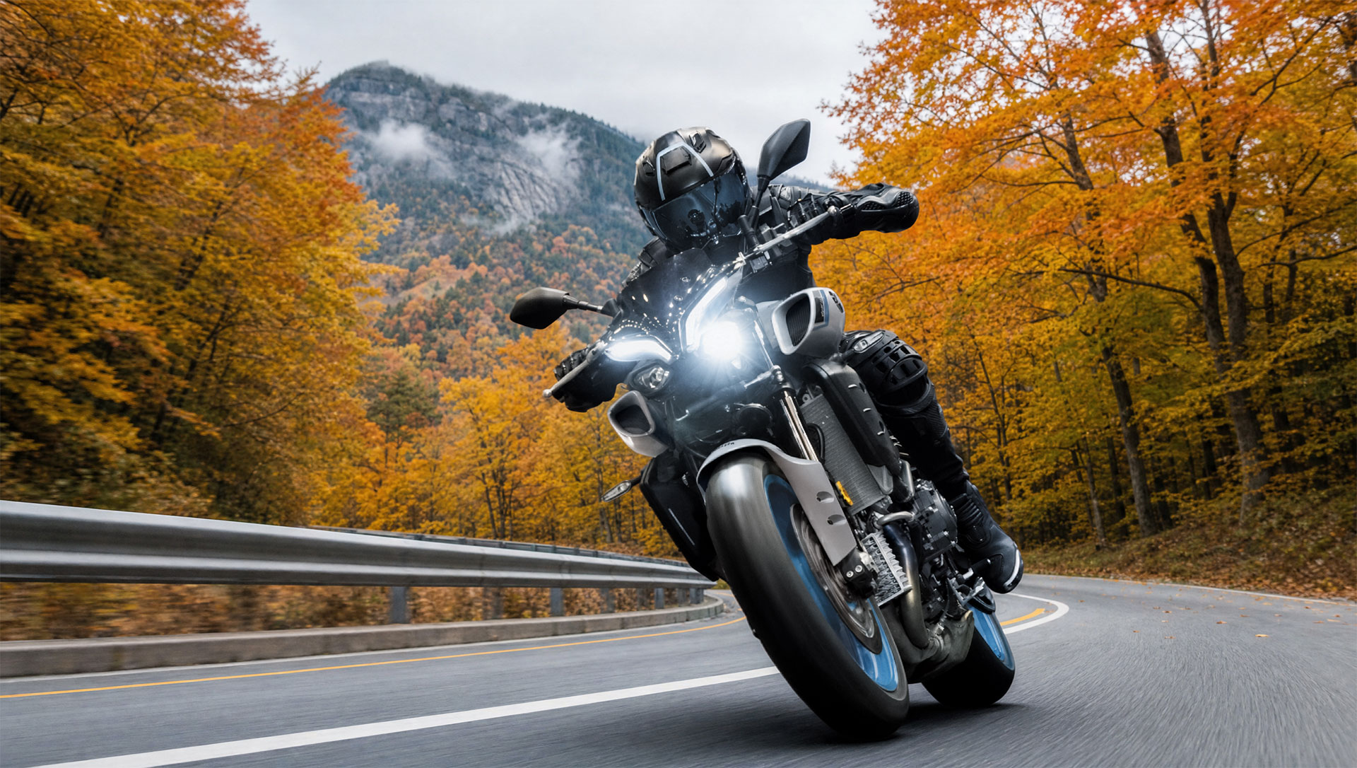
Thumb the starter in a hotel lot in Asheville while the morning coffee is still too hot to drink. The MT-10 settles into its idle. Jacket zipped to the collar.
A few minutes later the Parkway ramp at U.S. 70 shows up in the headlight. Within a mile the city noise is gone, and there’s nothing ahead but two lanes and the first gray light over the ridges.
The destination is a sign at milepost 431.4. It puts Richland Balsam Overlook at 6,053 feet, the highest point anywhere on the Blue Ridge Parkway, and in the last week of September it’s one of the first places on the road where patchy color starts to show. Asheville sits about 4,000 feet lower and usually peaks a few weeks later. Riding from one to the other moves a rider forward through the season a mile at a time.
On a motorcycle with no fairing, every one of those miles is easy to feel.
The temperature change is easy to work out. Air cools by roughly three and a half degrees for every thousand feet of climb, so a 60-degree morning in Asheville can be closer to 46 at the top of the road, and that’s before adding the wind at 45 mph. The Parkway as a whole spans more than 5,000 feet of elevation, from under 650 feet at the James River in Virginia to over 6,000 in this stretch south of Mount Pisgah.
The MT-10 has no fairing and no hard bags. The layer that comes off by early afternoon rides in a tail bag or on the rider’s back, and the rider feels the cooler air across the chest, with no windscreen in the way.
Southbound from U.S. 70 to the end of the Parkway at U.S. 441 near Cherokee is about 86 miles, and as of late September 2026 all of it is open.
Hurricane Helene closed much of the North Carolina Parkway in September 2024. Repairs have since reopened most of it, but three sections between Linville Falls and Mount Mitchell remain closed, with the park service expecting the road work to finish by the end of 2026. The National Park Service updates its road status chart daily, and it’s worth checking every morning.
Fuel catches riders who know the Parkway only from photographs. No gas stations sit on the Parkway itself, only in the towns at the access points. The MT-10 carries 4.5 gallons against Yamaha’s estimate of 36 mpg, roughly 160 miles on a full tank. Asheville to Cherokee and back by the Parkway runs just over 170.
So the plan is to fill up in Cherokee before turning around, or to drop nine miles down U.S. 23/74 to Waynesville from Balsam Gap, milepost 443, on the way home.
Travel time needs the same kind of planning. The speed limit never climbs above 45 mph, and the park service figures about an hour for every 30 miles, which puts the southbound run near three hours before a single stop.
That pace was part of the design from the start. Ground was broken near Cumberland Knob, North Carolina, on September 11, 1935, and the last link, the Linn Cove Viaduct on Grandfather Mountain, was dedicated on September 11, 1987. Fifty-two years, to the day.
The usual objection to bringing a hyper naked here is that 45 mph uses a small fraction of what a 998cc CP4 crossplane engine derived from the YZF-R1 can do. That’s true, but it leaves out how the engine behaves at low speed. Yamaha describes the delivery as linear and torque-rich. On the climbs out of the gaps, that tends to mean fewer gear changes and an easy right hand.
Three intake ducts of different lengths are tuned to resonate at different engine speeds, and the Acoustic Amplifier Grilles on either side of the tank carry that induction sound straight to the rider. At Parkway speeds it’s easy to hear.
South of the French Broad River the road starts to climb and the tunnels begin. Pine Mountain Tunnel, near milepost 399, is the longest on the Parkway at 1,434 feet. A couple of miles later the three Ferrin Knob tunnels arrive in quick succession, named for the ferns that grow over them, which locals once called ferrins. Inside, the induction sound fills the bore and falls away the moment the far portal opens.
Tinted visors make the first one darker than expected. Wet leaves can gather at the tunnel mouths in fall, so the entries get taken a little slower than the exits.
Yamaha builds the MT-10 around an aluminum Deltabox frame derived from the R1 and a compact 55.3-inch wheelbase, and the bike weighs 467 pounds wet. Through the curves below Mount Pisgah, the agility Yamaha describes is easy to believe. Fully adjustable KYB suspension at both ends, with 4.7 inches of travel front and rear, leaves room to soften things for a day of patched mountain pavement. The six-axis IMU and four power modes are there underneath, and on this road they mostly stay in the background.
About 280 pullouts line the Parkway, more than 200 of them designated overlooks, and on a clear fall morning plenty of riders stop at more of them than they planned to. At one of them a couple on a loaded touring bike is standing at the stone wall with a paper map spread across the seat. They want to know where the next gas is. It’s in Waynesville or Cherokee, and as usual the conversation ends with somebody pointing south.
Past the Pisgah area, where the campground sits at almost 5,000 feet, the forest changes. Hardwoods give way to red spruce and Fraser fir, and on a still morning the air at the Richland Balsam overlook smells like a Christmas tree lot that someone forgot to close. Helmet on the mirror, gloves on the seat. The self-guided loop trail from the overlook runs about a mile and a half through that forest to the summit, and the spruce smells stronger under the trees than it does in the parking area.
From there the road falls toward Balsam Gap and climbs again to Waterrock Knob at milepost 451.2, where the overlook faces east across ridge after ridge going blue with distance. It’s the last long view before the descent. The last 18 miles drop through Soco Gap and into Cherokee, where the Parkway ends at the edge of Great Smoky Mountains National Park.
At the pump in Cherokee the tank takes a little over two gallons, give or take how the climbs went. That’s when the fuel planning from breakfast pays off.
Heading back, the ridges that were gray at dawn have gone bronze and gold at the top. The clothing layer that came off at Waterrock stays in the tail bag.
The rest of the season follows the same road downhill. Color at 4,000 to 5,000 feet usually peaks around the second week of October and reaches Asheville by the end of the month, and October weekends are the Parkway’s busiest.
A rider who goes in the last days of September, midweek if possible, gets the top of the road first and most of it without company. Check the park service’s road status chart the night before and fill up in Asheville.
There’s no hurry on a road built for 45 mph, and the MT-10 doesn’t ask for one.